INGV
Sezione di Pisa
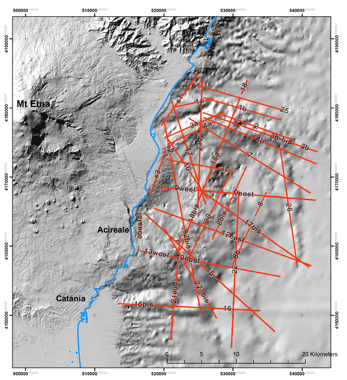
This website is dedicated to the visualization and to get information from S.O.M.E. database. S.O.M.E consists of ~480 km of high resolution 2D multichannel seismic data acquired in 2005 in the Ionian Sea, offshore Mount Etna (southeast Sicily, Italy). The surveyed area consists of a sea sector from Catania to Taormina (latitude 37° 25’ 00”N - 37° 50’ 00”N and from the coast to longitude 15° 30’ 00”E) and from 100 m b.s.l. along the coast to a depth of 2000 m b.s.l. in the bathyal zones.
The survey was aimed to image with the highest
resolution the very shallow structure of the crust off-shore
Mount Etna, a total of 39 seismic lines have been processed and
recorded in SEG-Y format. The dominant frequency of the
reflected signal throughout the sections was about 90 Hz. In
this acoustic framework the vertical resolution limit is 5 – 7
m, while the horizontal limit is about 200 m at 2.0 s two way
travel time (TWT), all the recorded lines have a maximum depth
of 3.0 s (TWT).
The website is addressed to specialized users
which are familiar with seismic data processing and analysis,
but anyone interested in seismic imaging of crustal structures
in the offshore on Mount Etna can explore the database.
Use the image below to browse in the preview of database (click on line number) or download .
The S.O.M.E. database is published with a CC BY 4.0 license and can be used freely, even partly, but it must be cited as follows.
Francesco Mazzarini, Ilaria Isola, Marina Bisson, Luca Nannipieri, Massimiliano Favalli, Alessandro Fornaciai, Simone Tarquini (2017). Seismic lines Offshore Mount Etna (SOME): open database , Annals of Geophysics 60, 5, 2017, S0557, doi: 10.4401/ag-7346
Users explicitly accept this Disclaimer